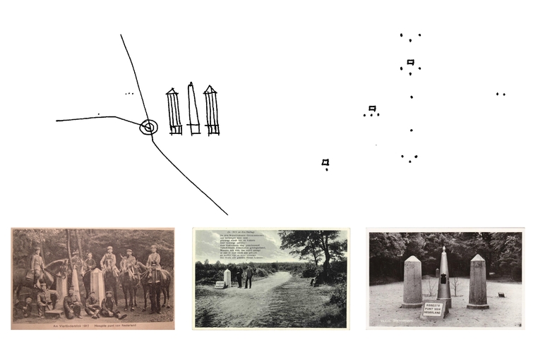
The story of the place, the ‘genius loci’, always provides unbiased and appealing guidance to tie in with the present-day developments in a region. It didn't appear to be otherwise for the Drielandenpunt: the agency discovered that old postcards depicted the story of the history of many dozens of border poles that are located on the hill, the
Vierlandenpunt
, a prehistoric barrow and the Highest Point. After a thorough examination of the postcards, it seemed that the highest point and various border poles had changed. At this moment the highest point of the Netherlands is marked by a monument with three border poles and an engraved stone which states “
Hoogste Punt van Nederland
” [Highest Point of the Netherlands]. This has not always been the case: in the olden days the border poles and the engraving itself were situated at the real Drielandenpunt, 50 metres further along. Clarity was brought during an interview with a historian at the Municipality of Vaals: indeed, there's a whole history to be told about the monuments on the hill. Then an investigation was carried out where the highest point is actually situated and it appeared that this lies about 250 metres further to the West. Not only did it appear that the Drielandenpunt had looked very different, but the highest point of the Netherlands on the European mainland had already been indicated incorrectly since 1928. Generations of visitors had therefore stood at the wrong place! Such a discovery, which exposes precisely why everyone near the Drielandenpunt feels that something is wrong, clarifies this feeling in one fell swoop. So it was high time to set the record of this falsified past straight, and to give the Drielandenpunt an improvement of quality: placing border poles at the right spots and the marking of a new “Highest Point of the Netherlands on the European mainland”. A densely wooded, green area which tells the border stories to visitors and lets them experience the magic of the hilltop. The redevelopment of the Drielandenpunt is embedded in a larger concept, where one can walk over the three borders across pathways, and which introduces a natural path at the line +300 m NAP, and provides access to a place on the hill for a new high-grade investment location. The plan also includes a new monument for the highest point: of course, this is the project that MTD landschapsarchitecten is currently working on...